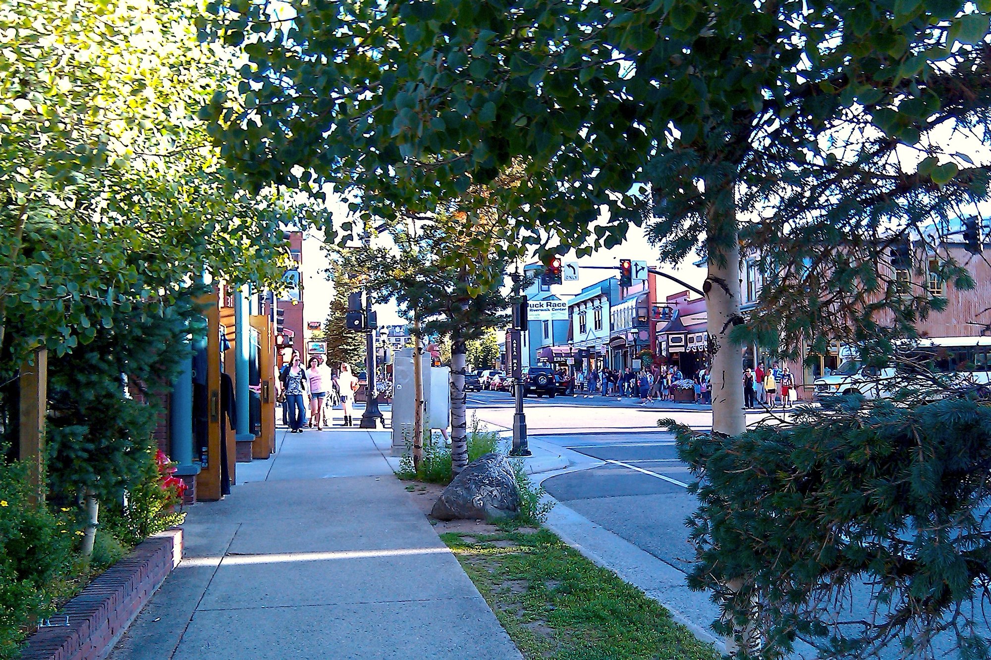
Main Street in historic Breckenridge

Outdoors

Wildlife viewing and birding near Breckenridge

Refuges, lakes and wild areas near Breckenridge for wildlife viewing and birdwatching.

24places to see wildlife
5 mito the closest
14within 30 miles

Good to know: Early mornings and evenings are best for wildlife; bring binoculars and keep a respectful distance.

Closest picks

1

Peak One

5 mi north · USDA Forest Service

Peak One Campground is located on the Dillon Reservoir near the town of Frisco, offering an abundance of recreational activities. The reservoir is encircled by Swan Mountain and the dramatic Gore and Tenmile Ranges.
2

Lowry Campground

6 mi north · USDA Forest Service

At an elevation of 9,320 feet, Lowry Campground is located between Summit Cove and Breckenridge, Colorado in the White River National Forest.

3

Prospector

6 mi north · USDA Forest Service

At an elevation of 9,000 feet, Prospector Campground is in the heart of Summit County in the White River National Forest.

Map of all 24 places

Map of 24 places loads as you scroll.

Within 30 miles (14)

5 mi north · USDA Forest Service · Campground

Peak One

Peak One Campground is located on the Dillon Reservoir near the town of Frisco, offering an abundance of recreational activities. The reservoir is encircled by Swan Mountain and the dramatic Gore and Tenmile Ranges.

  • Biking
  • Boating
  • Camping
  • Fishing
  • Hiking
  • Wildlife viewing

6 mi north · USDA Forest Service · Campground

Lowry Campground

At an elevation of 9,320 feet, Lowry Campground is located between Summit Cove and Breckenridge, Colorado in the White River National Forest.

  • Boating
  • Camping
  • Fishing
  • Hiking
  • Wildlife viewing

6 mi north · USDA Forest Service · Campground

Prospector

At an elevation of 9,000 feet, Prospector Campground is in the heart of Summit County in the White River National Forest.

  • Biking
  • Boating
  • Camping
  • Fishing
  • Hiking
  • Wildlife viewing

7 mi north · USDA Forest Service · Campground

Heaton Bay

Heaton Bay Campground is situated at an elevation of 9,000 feet and centrally located for recreation and relaxation in the White River National Forest.

  • Boating
  • Camping
  • Fishing
  • Hiking
  • Wildlife viewing

7 mi north · USDA Forest Service · Campground

Windy Point Group (Co)

Windy Point is located near Dillon Reservoir at an elevation of 9,000 feet in the White River National Forest. The site consists of a group camp and a group picnic shelter that can accommodate up to 100 people each.

  • Boating
  • Camping
  • Fishing
  • Hiking
  • Picnicking
  • Wildlife viewing

13 mi southeast · USDA Forest Service · Campground

Roberts Cabin

Roberts Cabin is one of the recognized historic cabins in Pike & San Isabel National Forests.

  • Camping
  • Fishing
  • Hiking
  • Hunting
  • Wildlife viewing

15 mi southwest · USDA Forest Service · Campground

Camp Hale East Fork Group

Located in the wide-open spaces of a lush green valley near the headwaters of the Eagle River and East Fork Eagle River, Camp Hale East Fork is the ideal spot for large group camping.

  • Camping
  • Fishing
  • Hiking
  • Wildlife viewing

15 mi northwest · USDA Forest Service · Campground

Gore Creek Campground

Gore Creek Campground is situated six miles east of Vail, Colorado, at an elevation of 8,700 feet and centrally located for recreation and relaxation in the White River National Forest.

  • Biking
  • Camping
  • Hiking
  • Wildlife viewing

16 mi southwest · USDA Forest Service · Campground

Camp Hale Memorial

Camp Hale Memorial Campground sits at an elevation of 9,200 feet, offering guests a wonderful setting for recreation and relaxation.

  • Biking
  • Camping
  • Fishing
  • Hiking
  • History
  • Wildlife viewing

16 mi southwest · Bureau of Land Management

Mosquito Peaks

This beautiful high-alpine tundra and Area of Critical Environmental Concern contains significant biodiversity. There are several small parcels of BLM land here, with unique geological formations and 18 rare plant species.

  • Camping
  • Hiking
  • Off-highway vehicles
  • Wildlife viewing

16 mi east · USDA Forest Service · Campground

Timberline Campground

The Timberline Campground, near Kenosha Pass, is about 7 miles southwest of the small town of Grant. The abundance of aspens at the site creates impressive fall scenery along the forested hillside.

  • Biking
  • Camping
  • Fishing
  • Hiking
  • Hunting
  • Wildlife viewing

17 mi east · USDA Forest Service · Campground

Geneva Park Campground

At an elevation of 9,813 feet, Geneva Park Campground offers cooler temperatures during the hottest of summer months.

  • Biking
  • Camping
  • Hiking
  • Hunting
  • Wildlife viewing

17 mi southeast · USDA Forest Service · Campground

Kenosha Pass Campground

Kenosha Pass Campground is a small, conveniently-located campground heralded by backpackers on the Colorado Trail and by those looking for a scenic, mountain family getaway.

  • Biking
  • Camping
  • Fishing
  • Hiking
  • History
  • Wildlife viewing

30 mi northwest · Bureau of Reclamation

Green Mountain Reservoir

The dam is on the western slope 13 miles southeast of Kremmling, Colorado, on the Blue River, a tributary of the Colorado. Recreational developments include 6 campgrounds, 208 campsites, and 2 boat-launch facilities. Good access.

  • Biking
  • Boating
  • Camping
  • Fishing
  • Hiking
  • Picnicking
  • Recreational Vehicles
  • Water sports

30 to 75 miles (10)

38 mi west · Bureau of Land Management

Bocco Mountain

Bocco Mountain Recreation Area is a small upland riding area with fantastic scenery.There are 18 miles of single-track trails open to non-motorized uses and motorcycles only. Roads are two-track and open to all vehicles.

  • Biking
  • Camping
  • Hiking
  • Off-highway vehicles
  • Wildlife viewing

41 mi northwest · Bureau of Land Management

Upper Colorado River Recreation Area

Remember your OUTDOOR ETHICS when enjoying your public lands. Please RECREATE RESPONSIBLY.

  • Boating
  • Camping
  • Fishing
  • Hiking
  • Photography
  • Water sports
  • Wildlife viewing

44 mi north · Bureau of Reclamation

Lake Granby

Granby Dam and Lake Granby, features of the Colorado-Big Thompson Project are on the Colorado River near Granby, Colorado. Developments include 260 campsites and 3 boat-launch ramps.

  • Biking
  • Boating
  • Camping
  • Fishing
  • Hiking
  • Picnicking
  • Recreational Vehicles
  • Wildlife viewing

50 mi east · US Army Corps of Engineers

Bear Creek Lake

Bear Creek Dam, the last of three dams built to protect the Denver region from floods, is located on the southwest edge of suburban Lakewood at the confluence of Bear Creek and Turkey Creek.

  • Biking
  • Boating
  • Camping
  • Fishing
  • Hiking
  • Horseback riding
  • Hotel/Lodge/Resort Privately Owned
  • Picnicking

52 mi east · US Army Corps of Engineers

Chatfield Lake

Chatfield Dam, located southwest of Denver on the South Platte River, was the second of three dams built to protect the Denver region from floods.

  • Biking
  • Boating
  • Camping
  • Fishing
  • Hiking
  • Horseback riding
  • Picnicking
  • Water sports

55 mi northeast · Fish and Wildlife Service

Two Ponds National Wildlife Refuge

Two Ponds National Wildlife Refuge is a natural oasis with native wildlife and plants in an urban setting.

  • Birding
  • Educational Programs
  • Hiking
  • Photography
  • Ranger programs
  • Wildlife viewing

56 mi northwest · Bureau of Land Management

King Mountain

The King Mountain SRMA is unique due to its remoteness and proximity to the Flat Tops Wilderness and its huge elk herd.

  • Camping
  • Fishing
  • Hunting
  • Wildlife viewing

56 mi southwest · Bureau of Reclamation

Taylor River State Wildlife Area

Recreation at Taylor River State Wildlife Area is managed by the Colorado Division of Wildlife under agreement with the Bureau of Reclamation. The Division of Wildlife can be reached at 970-641-7070; e mail dan.brauch@state.co.us.

  • Camping
  • Fishing
  • Hiking
  • Picnicking
  • Wildlife viewing

57 mi south · USDA Forest Service

Pike and San Isabel National Forests & Cimarron and Comanche National Grasslands

Peaks to Prairies - Tracks to Trails Pike and San Isabel National Forests & Cimarron and Comanche National Grasslands ( forest locator map ) cover nearly 3 million acres, between the prairies of western Kansas and some of Colorado's…

  • Biking
  • Boating
  • Camping
  • Climbing
  • Fire Lookouts/Cabins Overnight
  • Fishing
  • Hiking
  • Horse Camping

61 mi north · National Park Service

Rocky Mountain National Park

Located in northern Colorado, visitors to Rocky Mountain National Park can explore over 415 square miles (265,807 acres) within the Southern Rocky Mountains.

  • Biking
  • Camping
  • Climbing
  • Fishing
  • Hiking
  • History
  • Horseback riding
  • Picnicking

Distances are straight-line miles from downtown Breckenridge. Listings come from Recreation.gov’s federal recreation database; check each official page for hours, fees, fire restrictions and closures before you go.

Get outside around Breckenridge

Breckenridge Colorado Troll // Easy Hike for Family video thumbnail

THINGS TO DO · YOUTUBE SHORT

Breckenridge Colorado Troll // Easy Hike for Family

A local activity Short shared by Salty Vagabonds .

Watch on YouTube ↗
5 Must Visit Spots on your Trip to Breckenridge, Colorado video thumbnail

THINGS TO DO · YOUTUBE SHORT

5 Must Visit Spots on your Trip to Breckenridge, Colorado

A local activity Short shared by Shawn Singh.

Watch on YouTube ↗

Around Breckenridge

Björn's Colorado Honey Breckenridge Product Shelving
Björn's Colorado Honey Breckenridge Product ShelvingAspensmonster · CC BY-SA 4.0
Breckenridge Brewery Interior 2015
Breckenridge Brewery Interior 2015Kayt Smith · CC BY-SA 3.0
BROWN HOTEL, BRECKINRIDGE, COLORADO, Breckenridge
BROWN HOTEL, BRECKINRIDGE, COLORADOJERRYE AND ROY KLOTZ MD · CC BY-SA 3.0

More outdoors near Breckenridge

Questions

Where is the closest place for wildlife & birding near Breckenridge?

Peak One (USDA Forest Service), about 5 miles north of Breckenridge as the crow flies. Next are Lowry Campground (6 mi) and Prospector (6 mi).

Who manages these places?

Federal agencies including USDA Forest Service, Bureau of Land Management, Bureau of Reclamation. Each listing links to its official page for hours, fees, closures and current conditions.

Breckenridge AI

Your Breckenridge local guide
Hey there!

I'm Breckenridge AI. Ask about neighborhood food, independent shops, local history or planning a visit.

AI recommendations may be inaccurate. Verify hours and prices. Questions are processed by Cloudflare. Privacy